Tropical Storm Cristobal forms, second disturbance likely to form soon
One disturbance has an 80% chance of development and could reach the Lesser Antilles this weekend
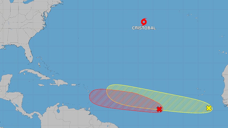
NEW ORLEANS (WVUE) - Tropical Storm Cristobal formed Wednesday (Aug. 12) over the central subtropical Atlantic as forecasters monitor two other systems farther south that could develop while moving west across the Atlantic.
Cristobal became the third named storm of the 2026 Atlantic hurricane season, but the newly formed storm is expected to be short-lived and remain far from the United States.
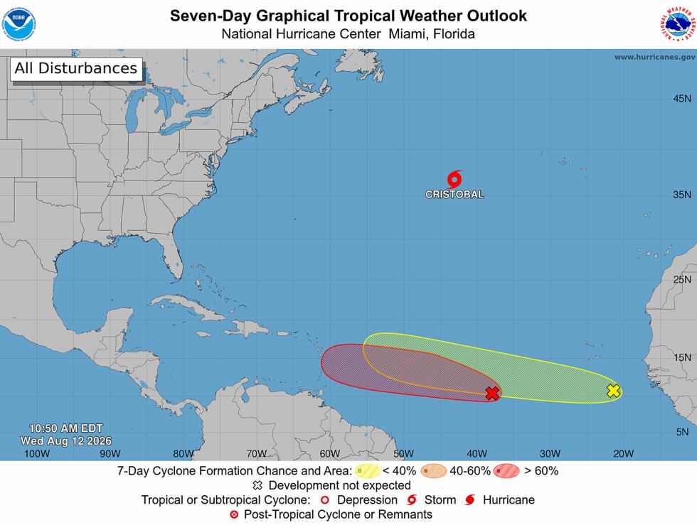
Meanwhile, a separate disturbance over the central Atlantic has an 80% chance of developing during the next seven days and is forecast to move toward the Lesser Antilles this weekend.
Another tropical wave moving off the coast of Africa has a 30% chance of development during the next seven days.
Tropical Storm Cristobal forms
The National Hurricane Center began issuing advisories on Tropical Storm Cristobal Wednesday morning after satellite data showed the system had developed a better-defined circulation and tropical-storm-force winds.
As of 10 a.m. CDT, Cristobal had maximum sustained winds of 45 mph and was located about 880 miles west of the Azores.
The storm was moving quickly east at 25 mph.
Cristobal is expected to turn toward the east-northeast and slow down later Wednesday and Wednesday night.
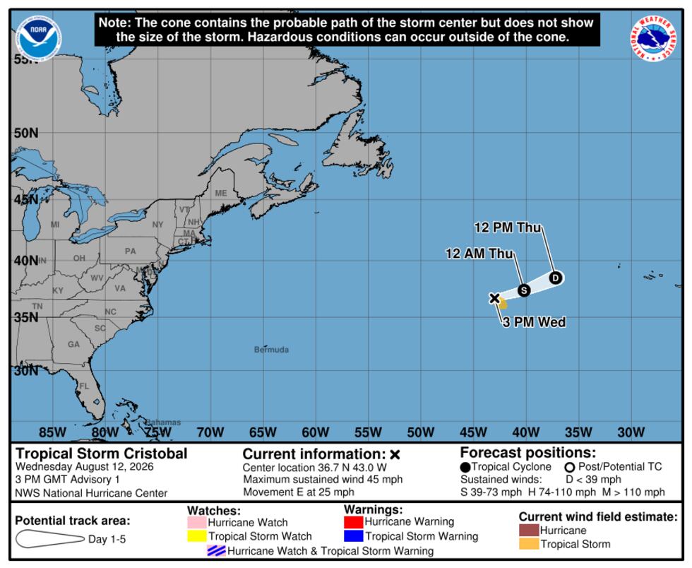
Forecasters expect the storm to encounter cooler waters, drier air and stronger wind shear, causing it to weaken. Cristobal is forecast to fall below tropical storm strength Thursday and dissipate by Thursday evening.
Tropical-storm-force winds extend up to 90 miles from the center.
There are no coastal watches or warnings in effect.
Central Atlantic disturbance could develop soon
Of greater interest for the Caribbean is Invest AL92, a tropical wave and area of low pressure over the central Atlantic.
Showers and thunderstorms associated with the system have shown signs of organization, and the NHC says environmental conditions are expected to support additional development during the next few days.
A tropical depression is likely to form within the next couple of days as the disturbance moves west to west-northwest at 10 to 15 mph.
The system has an 80% chance of tropical development during the next seven days.
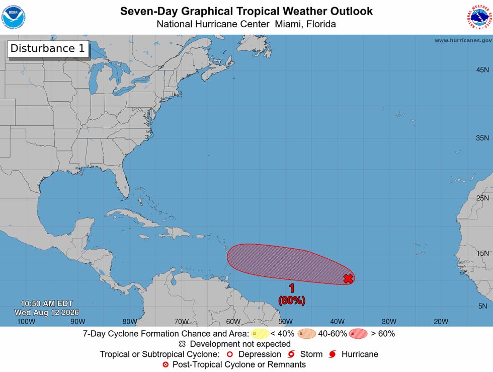
Forecasters expect the disturbance to continue across the central tropical Atlantic and reach the Lesser Antilles over the weekend.
Because the system has not yet developed into a tropical cyclone, there is no official forecast track or intensity forecast. Its eventual path beyond the Lesser Antilles remains uncertain.
Another wave emerges from Africa
Forecasters also are watching another tropical wave moving west away from the African coast.
The system has a 30% chance of tropical development during the next seven days, according to the NHC.
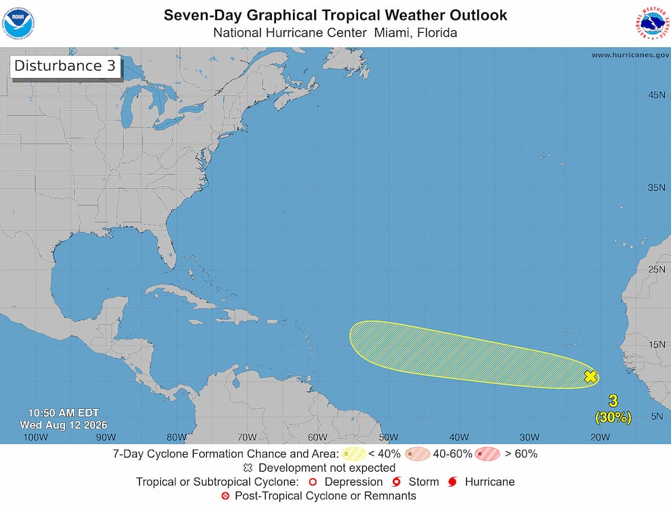
The wave was moving west at 10 to 15 mph Wednesday, with showers and thunderstorms developing ahead of it over the eastern tropical Atlantic.
It remains several days away from the Caribbean.
See a spelling or grammar error in our story? Click Here to report it. Please include the headline.
Subscribe to the Fox 8 YouTube channel.
Copyright 2026 WVUE. All rights reserved.