Francine exits Louisiana, leaving widespread flooding and power outages
Power outages began piling up as Francine pushed inland

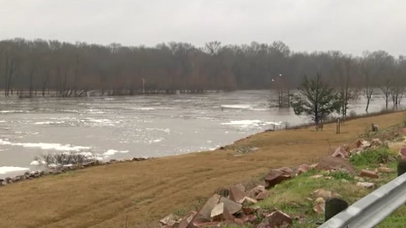
NEW ORLEANS (WVUE) - Francine struck Louisiana on Wednesday (Sept. 11) as a Category 2 storm, knocking out power to more than 300,000 customers and inundating southeast parishes with flooding rains.
The National Hurricane Center said Francine made landfall in southern Terrebonne Parish just before 5 p.m., 30 miles south-southwest of Morgan City, with sustained winds of 100 mph. At least one building in Houma, a flea market, was destroyed.
Winds decreased as the eye moved over the river parishes towards metropolitan New Orleans. Conditions quickly worsened and several neighborhoods experienced flash flooding and overtopped canals, especially in the Jefferson Parish communities of Kenner, LaPlace, and Metairie.
By 9 p.m., the worst conditions were moving across the lake to the North Shore. Francine was downgraded to a tropical storm with 70 mph winds at 10 p.m. After midnight, rains moved to Washington Parish and Francine was on its way out of Louisiana.
Power outages began piling up across the area as Francine pushed inland. Over 380,000 people were without power several hours after landfall. Entergy crews can not begin repairs until winds dipped below 30 mph.
IMPORTANT LINKS
- Fox 8 Hurricane Center
- Download the Fox 8 News and Weather app
- SUBMIT: Photos, videos of Francine impacts in southeast Louisiana
- View Entergy power outages here - all other providers at poweroutage.us
By 9 p.m., Jefferson Parish saw upwards of nine inches of rain. Officials urged residents to stay off the roads. “We’re past the point where canals and pumps are overwhelmed,” Councilman Scott Walker said. “Canals have overflowed and street flooding is widespread.”
Jefferson Parish president Cynthia Lee Sheng said there were reports of overtopping canals along West Esplanade and West Napoleon and “structural flooding” in some locations on the east bank.
“The pumps are working,” she said. “Earlier today, we took on so much rain, probably averaging 7-9 inches of rain. Some areas of the east bank took on 11 inches of rain. So, it was just a situation where we were outpaced by the storm. We just could not keep up with pumping capacity.”
New Orleans City Councilman Joe Giarrusso said a brief loss of power delayed the Sewerage & Water Board’s pumps from relieving street flooding issues. Several streets in Mid-City and New Orleans East flooded. A representative from SWBNO was not made available for on-air interviews.
St. Charles Parish President Matt Jewell said officials had received reports of parish-wide street flooding, leading to water in homes.
St. John the Baptist Parish saw 5-7 inches of rain, leading to significant street and localized flooding. Parish President Jaclyn Hotard said multiple structures took on water, though she did not have an exact count.
The weakening storm seemed to have mostly spared north shore communities in Tangipahoa, St. Tammany, and Washington parishes. However, more than 50,000 were without power and a tornado watch was in effect until 6 a.m. Thursday. Damage reports were minimal, outside of downed trees and power lines.
Damage assessments were slow coming from hard-hit Terrebonne and Lafourche parishes, where mandatory evacuations and curfews were implemented ahead of the storm.
Gov. Jeff Landry said residents should stay in place after landfall rather than venture out into waterlogged roads and risk blocking first responders or utility crews working to repair power lines.
Even after the storm passes, Landry said Louisiana residents should stay home and off of the roads as much as possible. It will make it easier for emergency responders and utility repairmen to move around if there is less traffic, he said.
“Make sure you charge all of your devices so you can keep the maximum amount of charge,” Landry said.
Maj. Gen. Thomas Friloux with the Louisiana National Guard said as many as 2,500 members will help with rescue and relief efforts. They are positioning themselves in southeast and south central Louisiana to assist after the storm.
The guard has prepared 58 boats, 101 high-water vehicles and 61 aircraft to use after the storm passes. It has another 270 vehicles in reserve if needed, Friloux said.
The Louisiana Department of Wildlife and Fisheries has 150 law enforcement agents with trucks and boats on standby to assist with the hurricane, Secretary Madison Sheahan said. More than 400 Louisiana State Police troopers are also available for help, according to Superintendent Col. Robert Hodges.
“If you are in the storm’s pathway, to understand, you may be without utilities for some time,” Landry said.
Recovery efforts from Francine should begin in earnest Thursday. Gov. Jeff Landry received approval late Tuesday from President Joe Biden for a federal disaster declaration, which fast-tracks resources from Washington to assist with matters such as storm cleanup and emergency housing.
See a spelling or grammar error in our story? Click Here to report it. Please include the headline.
Subscribe to the Fox 8 YouTube channel.
Copyright 2024 WVUE. All rights reserved.