Overnight severe weather threat possible
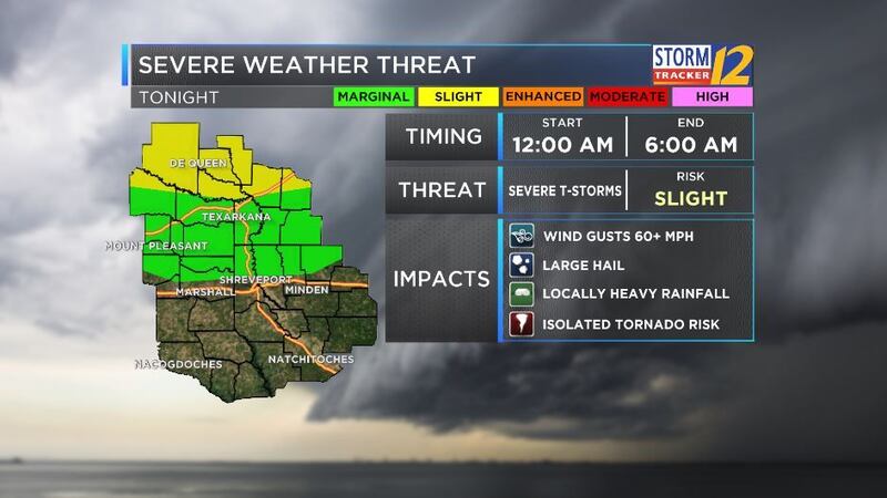
(KSLA) - This evening will bring the threat of strong to severe storms to the ArkLaTex. Storms will begin developing ahead of and along a cold front. The biggest threats from this system will be damaging wind, large hail and heavy downpours. A stronger tornado threat exists north of the region. However, an isolated tornado cannot be ruled out.
The cold front will begin tracking into the region after midnight. The severe threat will be greatest for areas north of the I-30 corridor.
Here is the latest timeline of FutureTrack for tonight's rain and storms:
8pm
Scattered showers and a few storms possible.
1am
Cold front will enter the region. A few stronger to severe storms possible at this time.
Nearing the I-30 corridor. Give yourself a few extra minutes if beginning your morning commute. Heavy downpours.
System moving into I-20 corridor. Severe threat diminishing, but a a few stronger storms possible.
11am
Line south of I-20. Rain and a few scattered storms. Severe threat low.
2pm
Cold front moves out of the region by early afternoon. Clear skies return.
You can keep up with the latest weather updates through the KSLA Stormtracker 12 Weather app. It is free to download from your app store.
Copyright 2017 KSLA. All rights reserved.